The author recalls how the implementation of a historic preservation easement over the Bristoe Station Battlefield in Prince William County helped ensure that the property remains undisturbed and protected in the interest of the public for research, education, and recreation.
By Kyle Edwards | DHR Easement Program Archaeologist
Virginia is home to 123 Civil War battlefields that are designated in the Civil War Sites Advisory Commission: Report on the Nation’s Civil War Battlefields. These battlefields are spread throughout the Commonwealth, from Balls Bluff to Saltville. Due to their ubiquity, these sites are often under the threat of development or destruction. This is particularly true in Northern Virginia, where suburban expansion has quickly consumed these once-contested grounds. Despite continued pressure from development, DHR and its coordinating partners have protected thousands of acres of Civil War battlefield lands through the Commonwealth’s historic preservation easement program.
Easements donated to the Commonwealth restrict future commercial development on historic properties and prohibit certain activities in order to protect a property’s historic character and resources. Through this program—with assistance from federal, state, and private funding—DHR works to preserve our shared history, provide parks for recreation and education, and maintain valuable open-space for local communities. One example of this is the Bristoe Station Battlefield, located in Prince William County. This battlefield has been under the persistent threat of residential and commercial encroachment for more than two decades, but today over 150 acres of the battlefield are protected and accessible to the public.
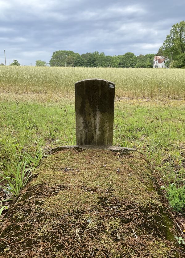
The little-known Battle of Bristoe Station occurred on October 14, 1863, and marked the close of the Confederate Army of Northern Virginia’s futile Bristoe Campaign. To draw the Union Army of the Potomac into battle and regain the initiative, Confederate General Robert E. Lee launched an offensive north of the Rappahannock River in early October. To counter this maneuver, Union Major General George G. Meade withdrew the Army of the Potomac north to occupy a defensive position closer to Washington, D.C. Lee subsequently ordered Confederate Lieutenant General A.P. Hill to pursue Meade and attack the retreating Federal troops. On the afternoon of October 14, Hill encountered what he thought was the rear of the retreating Union Army crossing Broad Run, near Bristoe Station, along the Orange and Alexandria Railroad. This was, in fact, the rear of the Union V Corps, but not the rear of the Army of the Potomac. The entire Union II Corps under Major Gen. Gouverneur K. Warren followed the V Corps up the railroad grade. Approaching Bristoe Station from the northwest, Hill deployed his divisions to attack the rear of the V Corp, directly to his front (Salmon 2001). This positioning placed the Union II Corps on their right flank as it moved northeast along the railroad. As Hill began his attack north toward Broad Run, Warren deployed his troops along the railroad embankment, hiding his full force from the Confederates until it was too late (Salmon 2001; National Register of Historic Places 1990). Union enfilading fire from this position decimated the Confederate ranks, resulting in over 1,300 casualties, while Warren lost fewer than half that number. The 27th North Carolina unit, which led one of the Confederate attacks, lost between half and two-thirds of its men (Gardiner et al. 2000). The Battle of Bristoe Station ended the offensive maneuvering of the Confederate Army in Northern Virginia, which withdrew as a result to winter quarters south of the Rappahannock. Warren’s victory also inflicted critical losses on a shrinking Confederate Army and was likely devastating for morale (Salmon 2001).

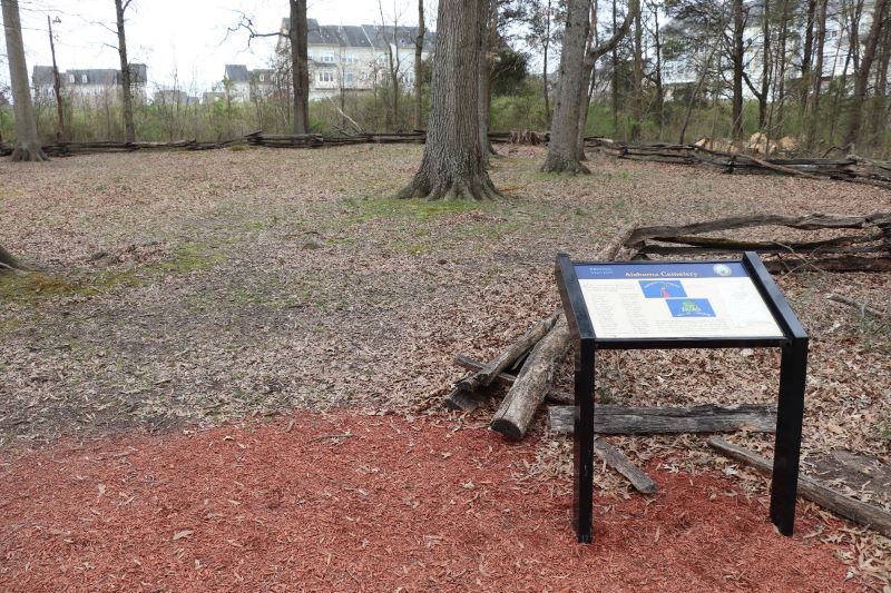
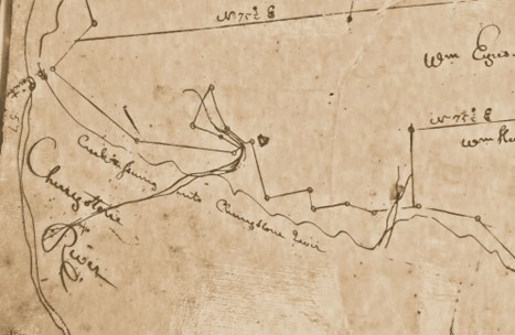
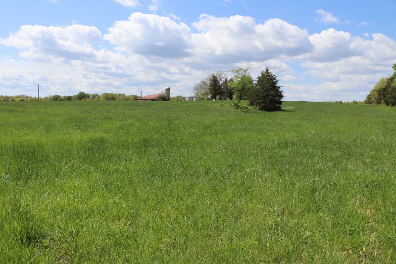
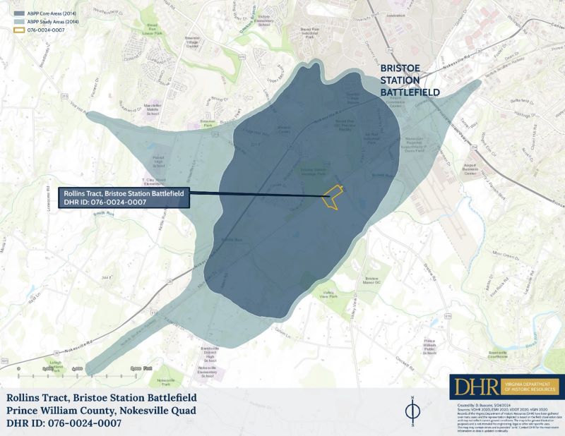
Despite the land preserved in 2009, the Bristoe Station Battlefield remains at risk of further encroachment from commercial development. As a result, Preservation Virginia placed the Bristoe Station Battlefield on its list of most endangered historical sites in the Commonwealth in 2014 and 2023. This fueled an ongoing desire to preserve more of the battlefield, which came to fruition this summer. On July 1, 2024, the American Battlefield Trust donated a historic preservation and open-space easement over 22.39 additional acres of the Bristoe Station Battlefield, known as the Rollins Tract, to the Virginia Board of Historic Resources (See Figure 1). The Trust was able to acquire this land through grants provided by the Virginia Land Conservation Foundation and the American Battlefield Protection Program. The Rollins Tract is significant because it is located just to the south of the rail corridor where Union troops of the II Corps took up positions prior to routing their Confederate attackers. The easement will maintain the historic character of the battlefield landscape and ensure that no archaeological remains will be unnecessarily disturbed. In the future, the property will be donated to Prince William County and added to the Bristoe Station Battlefield Heritage Park, allowing the County and DHR to continue their preservation partnership.
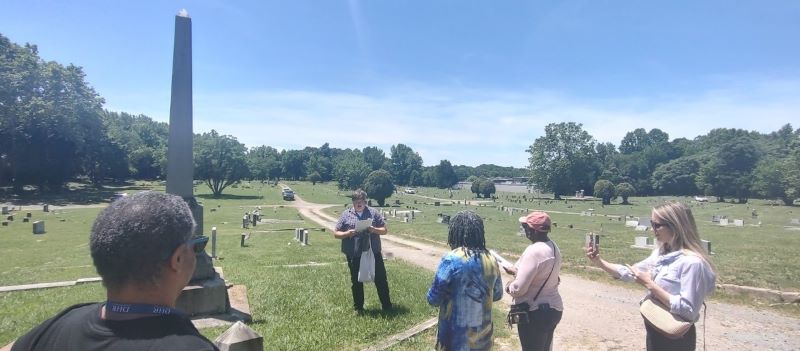
The preservation story of the Bristoe Station Battlefield is an excellent example of how a collaborative approach can help protect the Commonwealth’s historic treasures. Through the work of nonprofits, developers, government agencies, and the public, portions of the battlefield will remain undisturbed for future education, recreation, and study. DHR continues to work with the American Battlefield Trust and Prince William County to preserve additional acreage at Bristoe Station, which will further enhance the historic quality of area. Hopefully the success in Prince William can be recreated at other threatened sites.
References:
American Battlefield Trust. 2023. “A Tumultuous Path to Preservation at Bristoe Station”. https://www.battlefields.org/tumultuous-path-preservation-bristoe-station.
Blanton, Dennis and Charles Downing. 1990. A Phase I Cultural Resource Survey of the Proposed Commuter Rail Parking Lot and Layover Yard, Bristow, Prince William County Virginia. William and Mary Center for Archaeological Research. On File with the Virginia Department of Historic Resources.
Gardiner, William M., Kimberly A. Snyder, and Gwen Hurst. 2000. Phase I Archaeological Investigations of the New Bristow Village, Prince William County, Virginia. Thunderbird Archaeological Associates, Incorporate. On File with the Virginia Department of Historic Resources.
National Register of Historic Places. 1990. National Register of Historic Places Registration Form: Bristoe Battlefield. https://www.dhr.virginia.gov/wp-content/uploads/2019/10/076-0024_Bristoe_Battlefield_HD_1988_draft_nomination_delisted.pdf.
Preservation Virginia. 2014. “Preservation Virginia Announces 2014 Most Endangered Site List.” Last modified April 29, 2014. https://preservationvirginia.org/press_release/2014-most-endangered-historic-sites-list-press-release/.
Preservation Virginia. 2023. “2023 List of Virginia’s Most Endangered Historic Places Announced.” Last modified May 9, 2023. https://preservationvirginia.org/press_release/2023-list-of-virginias-most-endangered-historic-places-announced/.
Salmon, John S. 2001. The Official Virginia Civil War Battlefield Guide. Stackpole Books.
Waud, Alfred R., Artist. General Warren fighting at Bristoe station. Bristoe Station Virginia United States, 1863. Photograph. https://www.loc.gov/item/2004660830/.