Search
Close this search box.
/
/
What Do Archaeologists Do?

What Do Archaeologists Do?

Outreach: The archaeological community is active in creating programs for schools and giving talks to community groups and at professional conferences.

Preservation: Archaeologists are advocates for preservation and the care of historic resources.

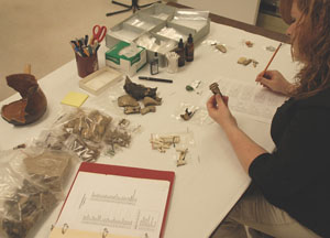
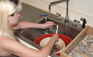
Lab work: Archaeology labatory activities include cataloging, conservation, analysis, and research.

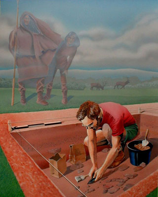
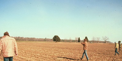
Field work: Archaeology field activities include survey, excavation, and remote sensing.

Resources for Virginia Archaeology

Find out about the ancient history of the native people of Virginia. Although these web pages span the entire spectrum of native cultural history, they barely scratch the surface of what archaeologists and other scholars are learning about native Virginians. Order through local bookstores or University of Virginia Press.

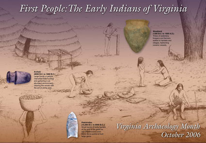
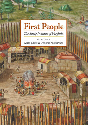
First People: The Early Indians of Virginia by Keith Egloff and Deborah Woodward:

This book incorporates recent events in the Native American community as well as additional information gleaned from publications and public resources. First People (second edition, 2006) brings to the fore a concise and highly readable narrative. Full of stories that represent the full diversity of Virginia’s Indians, past and present, this popular book remains the essential introduction to the history of Virginia Indians from the earlier times to the present day. Purchase through local bookstores, online or through University of Virginia Press.
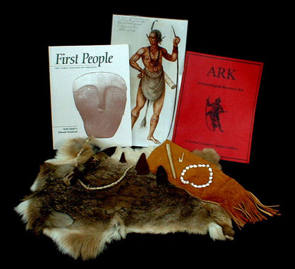

The Virginia Indian Archaeological Resource Kit (ARK). The ARK contains books, drawings, videos, replicas, and a computer game that give students a variety of ways to explore archaeology and the Indians of Virginia. The kit circulates on temporary loan at no cost. Museums, teachers, and educational organizations may make a reservation to borrow the kit by contacting Keith Egloff at 804.367.2323 ext. 131 (phone) or 804.367.2392 (fax); or contact the nearest Department of Historic Resources (DHR) regional office.
Barbara Heath under the sponsorship of the Council of Virginia Archaeologists. It is organized around three archaeological sites in Virginia and contains artifacts; artifact identification flash cards; maps and site plans; a card game based on foodways; and explanatory material on each site. The kit circulates at no cost. Museums, teachers, and educational organizations may make a reservation to borrow the kit by contacting Keith Egloff at 804.367.2323 ext. 131 (phone) or 804.367.2392 (fax); or contact the nearest Department of Historic Resources (DHR) regional office.
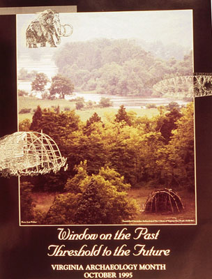
Archaeology-month poster 1995: Thunderbird
Archaeology-month poster 1999: Alexandria Archaeology
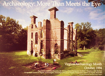
Archaeology-month poster 1994: Rosewell
Archaeology month poster 1992: Paleoarchaeology
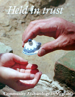
Archaeology-month poster 2006: First People

FAQ

Question: Where can I go to get more information on archaeology?
Answer: One can go to books, organizations, and websites.

Question: What are some good books that I can read?
Answer: There are many books and magazines on Virginia archaeology. Many of these publications are listed on websites.
Three good books to start with are: “First People: The Early Indians of Virginia” by Keith Egloff & Deborah Woodward; “Jamestown, The Buried Truth” by William M. Kelso, both published in 2006 by the University of Virginia Press; and “A Guide to Artifacts of Colonial America” by Ivor Noel Hume, University of Pennsylvania Press.

Question: Is there an organization that I can join?
Answer: The Archaeological Society of Virginia (ASV) is composed of a mix of professional archaeologists and other people who are interested in archaeology. Archeological Society of Virginia, 12106 Weyanoke Rd. Charles City, VA 23030. Phone: 804-829-2272. virginiaarcheology.org

Question: Is there a site where I can volunteer?
Answer: Please visit the Archeological Society of Virginia website for a listing of field schools and other field and lab opportunities across Virginia, or contact the ASV for more information.

Preservation

Almost all of what we know about people who lived here previously but did not leave written records has been learned from archaeological sites. It is important to understand the serious and urgent need to preserve these sites. Many are in danger of being destroyed. Each site is unique in the information it contains. It cannot be replaced. When sites are damaged before archaeologists can study them, the information–and our understanding of the past–is lost forever.
Sites are destroyed in two ways: by nature and by man. Natural forces wear down the earth’s surface and gradually remove traces of any markings, postmolds, and material remains. Normally, exposed areas on high or sloping ground are the ones most battered by wind, rain, and water. Rivers and the Atlantic Ocean also slowly erode land and can damage sites.
Man can unwittingly destroy sites in the normal course of constructing houses, roads, lakes, and factories. Even the very important work of cultivating fields to raise food may harm sites through soil erosion. A survey of an area before any building or farming begins can reveal the hidden assets beneath the ground. In some cases, developers have included newly discovered sites in their project plans. Some sites have become the focal point of a residential neighborhood or district, adding richly to a community’s sense of the past.
Unfortunately, man also destroys sites through acts of collecting. Artifact collectors often dig for treasure, hoping to discover something of great value. They sell the objects to make money or keep them to build a collection. Collectors place no cultural value on the site from which they are taking the artifacts. While they dig for treasure, they destroy the real find–hamlets, villages, and tribal centers that hold clues to our shared past. In just a few generations, the archaeological remains of 17,000 years of human activity could be nearly destroyed by progress and collecting.
Several laws help to protect archaeological sites in Virginia. The federal Archaeological Resource Protection Act (1979) and the Virginia Antiquities Act (1977) prohibit removing, without a permit, all cultural resources on government property. The Virginia Cave Act (1979) bars excavation without a permit within all caves and rockshelters. State burial laws prohibit removing, without a permit or court order, all human burials, regardless of age or cultural affiliation.
The National Historic Preservation Act (1966) requires review by archaeologists on federally funded, assisted, or permitted projects to consider their impact on important archaeological sites. Often this review results in the excavation of a site before construction, or altering the project plans to avoid the site. However, the fate of most archaeological sites is determined by private development, to which few if any guidelines apply.
Including archaeological sites on the Virginia Landmarks Register and on the National Register of Historic Places can also encourage their protection. These two registers do not regulate property owners, but they do encourage preservation of sites by calling attention to their special significance. Property owners wishing to provide for the permanent protection of significant sites can do so by granting a protective easement to the state or to some other appropriate organization.

Organize a Virginia Archaeology Month event in your community. Find a local museum, library, school, historical society, or other organization to sponsor an exhibit, lecture, or other event. The Department of Historic Resources or the Archeological Society of Virginia can help you develop ideas and find speakers. They can also send posters and other information to use at the event.

Read. The more you know about what can be learned through careful archaeological study and analysis, the better you can explain to others the importance of protecting archaeological sites. Both the Department of Historic Resources and the Archeological Society of Virginia publish books and reports about Virginia archaeology. Public and college libraries are good sources for both books and magazines about archaeology. You can also find Archaeology magazine in many bookstores.

Join the Archeological Society of Virginia. This statewide organization is made up of people like you who want to learn about Virginia’s history and prehistory by studying and protecting archaeological sites. The society publishes a newsletter and the Quarterly Bulletin with reports on archaeological sites and issues, and it sponsors many events each year. There may be a local chapter in your area with even more things to do. For more information visit: virginiaarcheology.org

Don’t dig. Each site is a unique page in the story of Virginia’s past. Whether it is for curiosity or greed, digging for any reason destroys the context of a site. If the site is skillfully excavated under the eye of an archaeologist, that unique page can be read, recorded, and retold. If that careful reading does not happen during excavation, then the site and its story are both gone forever; the recovered artifacts may look interesting, but their true meaning will remain obscure.

Participate in decisions that affect archaeological sites. Local governments and state and federal agencies that own property or that make decisions about zoning, permits, construction, highways, and similar activities that may damage archaeological sites usually have a way in which citizens can participate in those decisions. If you contact your local government or the individual agency to learn about these procedures, you can let the decision makers know that you think archaeological sites are important. This would also be a good project for a history or civics class as a way to learn how local governments make decisions.

Learn how to identify and report sites. We can’t preserve or study sites unless we know where they are. The Department of Historic Resources (DHR) maintains a list of sites all over Virginia. These lists can be used by researchers and by people making decisions about building roads and other large developments. Both the DHR and the Archeological Society of Virginia can help you report sites. For more information visit: virginiaarcheology.org

Join the Archaeological Conservancy. Consider joining the Archaeological Conservancy. The Conservancy actively seeks sites in Virginia to protect until they can be properly and conservatively researched. Membership in the Conservancy includes a subscription to American Archaeology magazine. For more information visit: http://www.americanarchaeology.com/

Volunteer to work on a site or in a lab. Many ongoing archaeological projects welcome volunteer assistance, especially to help process artifacts in the laboratory. Since digging–even by archaeologists–destroys the site being studied, make sure that the project you choose is one that is conducted to meet state and federal standards. The Department of Historic Resources maintains information on some of the projects that welcome volunteers. Contact the individual project sponsor for information on volunteer programs and schedules.

FAQ

Question: If I find an artifact, should I dig?
Answer: No. Each site is a unique page in the history of Virginia. Please contact a professional archaeologist to record the site.

Question: If I find an archaeological site, who should I tell?
Answer: Please contact a professional archaeologist at the Department of Historic Resources or refer to the Council of Virginia Archaeologists (COVA) website (http://cova-inc.org/) for a listing of professional archaeologists.

Question: If I want to preserve an archaeological site on my property, who should I contact?
Answer: Contact either the Department of Historic Resources or the Archaeology Conservancy.
Archaeological Conservancy, Eastern Regional Office, Director Andy Stout, 8 East 2nd Street, Suite 200, Frederick, MD 21701, 301.682.6359

Lab work

Lab work encompasses all the inside work that archaeologists do, once the artifacts have been excavated. This starts with washing, cataloging, mending, and conservation; goes to collection care of the artifacts and records; and finally leads to analysis, research, exhibit, and education.
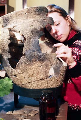
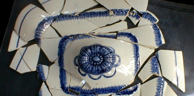
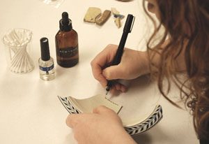
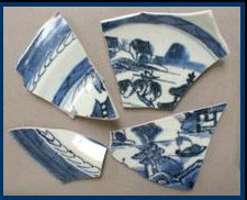
Artifacts that have been in the ground for hundreds if not thousands of years need to be cleaned. Labeling artifacts preserves the provenience of the artifact by writing the site number, provenience, and artifact number directly on the artifacts. Mending fits together broken fragments of an artifact, such as a pottery vessel. Check the "Dig Deeper" for more information, and click the "Try It!" icon to see if you can mend a plate.
Artifacts that have been in the ground for hundreds if not thousands of years need to be cleaned. Labeling artifacts preserves the provenience of the artifact by writing the site number, provenience, and artifact number directly on the artifacts. Mending fits together broken fragments of an artifact, such as a pottery vessel. Check the “Dig Deeper” for more information.
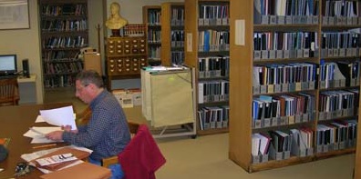
Documentary research involves the use of texts, maps and images as source materials. These can include: ethnographic writings, county records, newspapers, census publications, paintings, photographs, and diaries. Click the "Try It!" icon to see if you can use documents from the past.
Documentary research involves the use of texts, maps and images as source materials. These can include: ethnographic writings, county records, newspapers, census publications, paintings, photographs, and diaries.
Conservation is the careful treatment of artifacts so that they can be preserved, studied, and exhibited. A treatment plan is established based on each object's component materials and its condition. In general, objects are carefully cleaned, stabilized, and coated to stop further deterioration. Click on the "Try It" icon to see if you have the skill and patience to conserve an artifact.
Conservation is the careful treatment of artifacts so that they can be preserved, studied, and exhibited. A treatment plan is established based on each object’s component materials and its condition. In general, objects are carefully cleaned, stabilized, and coated to stop further deterioration.
Artifact cataloging consists of counting and describing the different types of artifacts from each excavated unit while retaining the provenience information. A single artifact or a group of similar artifacts may be assigned a unique artifact number. Different tables listing multiple attributes are used to catalog artifacts. Click the "Try It!" icon and see what you can learn about artifacts by looking at paintings.
Artifact cataloging consists of counting and describing the different types of artifacts from each excavated unit while retaining the provenience information. A single artifact or a group of similar artifacts may be assigned a unique artifact number. Different tables listing multiple attributes are used to catalog artifacts.
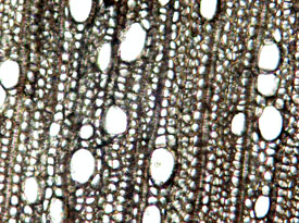
Scientific method is a body of techniques for investigating phenomena and acquiring new knowledge, as well as for correcting and integrating previous knowledge. It is based on gathering empirical and measurable evidence subject to specific principles of reasoning, the collection of data through observation and experimentation, and the formulation and testing of hypotheses. Archaeologists apply any scientific method that helps them learn about past people. These may include radiocarbon dating; protein residue analysis; x-ray spectrometry; neutron activation studies; trace element analysis; and bone, charred plant, shell, phytolith, pollen, and starch identification. Click the "Dig Deeper" icon to learn more.
Scientific method is a body of techniques for investigating phenomena and acquiring new knowledge, as well as for correcting and integrating previous knowledge. It is based on gathering empirical and measurable evidence subject to specific principles of reasoning, the collection of data through observation and experimentation, and the formulation and testing of hypotheses. Archaeologists apply any scientific method that helps them learn about past people. These may include radiocarbon dating; protein residue analysis; x-ray spectrometry; neutron activation studies; trace element analysis; and bone, charred plant, shell, phytolith, pollen, and starch identification. Check the “Dig Deeper” to learn more.
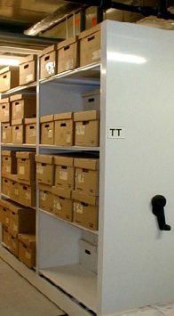
Artifacts are cared for much like books at a library. The provenience of each artifact is retained by placing the labeled artifacts into acid-free resealable-zipper plastic bags and then into acid-free boxes. All bags and boxes are labeled with site, provenience, and artifact information. The boxes are stored on shelves in a climate-controlled environment. Box content information is entered into a database so that collections and artifacts can be retrieved and returned easily. Click the "Dig Deeper" icon for some images.
Artifacts are cared for much like books at a library. The provenience of each artifact is retained by placing the labeled artifacts into acid-free resealable-zipper plastic bags and then into acid-free boxes. All bags and boxes are labeled with site, provenience, and artifact information. The boxes are stored on shelves in a climate-controlled environment. Box content information is entered into a database so that collections and artifacts can be retrieved and returned easily. Check the “Dig Deeper” for some images.

Dig Deeper

Labeling artifacts preserves the provenience of the artifact by writing the site number, provenience, and artifact number directly on the artifacts. The label is placed in an unobtrusive place on the artifact and does not obscure any diagnostic attributes. The label should be as small as possible. The label should also be reversible, which is achieved by placing the number on a coat of sealant that may be removed easily with a solvent.
Mending fits together broken fragments of an artifact, such as a pottery vessel. Mending allows the archaeologist to see the artifact in a more complete form for research or for exhibit. Cross-mends fit together fragments of a single artifact that have been found in different soil layers or features, that is, from different proveniences. Thus, cross-mending provides clues that allow one to infer relationships among various parts of a site.
Artifacts that have been in the ground for hundreds if not thousands of years need to be cleaned. Most artifacts are cleaned with water, but if they are too fragile, they may be dry-brushed instead. A soft brush is used that does not mar the surface of the object. Only one bag of artifacts at a time is cleaned to assure that objects from different proveniences are not mixed together. The cleaned artifacts are placed in a drying tray with a label containing all the provenience information.

FAQ

Question: What is an artifact?
Answer: An artifact is a general term for tools, weapons, utensils, and other items used by humans.

Question: How do you know the age of an artifact?
Answer: For sites that contain layers of soil, the artifact in the lowest layer is oldest.
Radiocarbon dating, developed in the 1940s, is an absolute dating technique commonly applied in archaeology on prehistoric sites. Anything that was once alive can be radiocarbon dated. Thus any artifacts found in association with material that has been radiocarbon dated are dated by association.
On historic sites, the age of artifacts can often be determined by researching early documents.

Question: How do you catalog an artifact?
Answer: A catalog is the description and count of artifacts. Different tables with multiple attributes are used to catalog artifacts. The artifact catalog is entered into a database so that archaeologists can search on artifact type or any combination of attributes.

Question: How do you conserve a rusty iron artifact?
Answer: Conserving any artifact, depending on the type of material, is a specialized science that only professionally trained people can do well. A conservator will proceed through steps that clean, stabilize, desalinate, and seal the artifact from further corrosion.

Field work

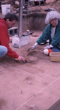
Field work encompasses all the outside work that archaeologists do. In general, this includes looking for sites — surveying; evaluating their research potential — testing; and recovering information from the site — excavation. Archaeologists normally use shovels and trowels to excavate; various-size screens to recover a wide range of artifacts; paper, pencil, and transit to map and keep records; and cameras to document what was uncovered.
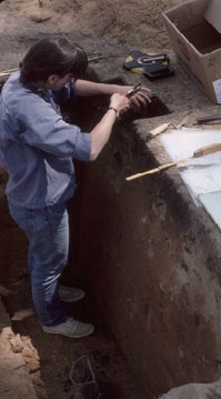
For an archaeologist, soil can hold much information. In fact, soil may be the most important artifact at an archaeological site! Soil samples are often taken from well-provenienced layers and features in order to recover the smallest items. The soil samples may be water-screened or floated, or they may be used for to analyze the amount of chemicals, pollen, phytoliths, or starch in the soil. Phytoliths are microscopic silica bodies created by plants, especially grasses and cereals. Each plant species has a distinct pollen and phytolith signature. Screening soil with water through fine mesh screens, rather than by hand through large mesh screens, can recover items as small as 1/16 inch. Items like small glass beads, fish bones, and charred nut and seed fragments may be recovered. Flotation is different from water screening. For flotation a soil sample is placed in water, agitated, and filtered through an extremely fine screen, leaving behind both a light fraction (items that float to the top, such as bits of charcoal or charred seeds) and a heavy fraction (items that do not float). The charcoal and charred nuts and seed fragments are then identified to help document the environment and what people gardened and gathered for their diet. Soil samples may be sent to a specialized laboratory to identify the pH readings and chemicals, such as phosphates and calcium in the soil. Soil chemical analysis is an important way to understand past activities that occurred in different locations within a site. Plants produce pollens and phytoliths that can be preserved in the ground for thousands of years and can provide detailed evidence of past environments. Pollen grains allow archaeologists to understand the trees, bushes, and plants from past environments and how people may have used them.
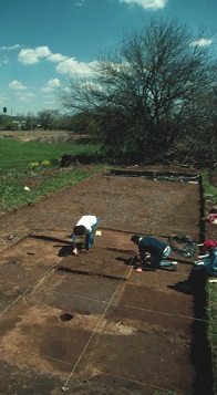
For an archaeologist, soil can hold much information. In fact, soil may be the most important artifact at an archaeological site! Soil samples are often taken from well-provenienced layers and features in order to recover the smallest items. The soil samples may be water-screened or floated, or they may be used for to analyze the amount of chemicals, pollen, phytoliths, or starch in the soil. Phytoliths are microscopic silica bodies created by plants, especially grasses and cereals. Each plant species has a distinct pollen and phytolith signature.
Screening soil with water through fine mesh screens, rather than by hand through large mesh screens, can recover items as small as 1/16 inch. Items like small glass beads, fish bones, and charred nut and seed fragments may be recovered.
Flotation is different from water screening. For flotation a soil sample is placed in water, agitated, and filtered through an extremely fine screen, leaving behind both a light fraction (items that float to the top, such as bits of charcoal or charred seeds) and a heavy fraction (items that do not float). The charcoal and charred nuts and seed fragments are then identified to help document the environment and what people gardened and gathered for their diet.
Soil samples may be sent to a specialized laboratory to identify the pH readings and chemicals, such as phosphates and calcium in the soil. Soil chemical analysis is an important way to understand past activities that occurred in different locations within a site.
Plants produce pollens and phytoliths that can be preserved in the ground for thousands of years and can provide detailed evidence of past environments. Pollen grains allow archaeologists to understand the trees, bushes, and plants from past environments and how people may have used them.
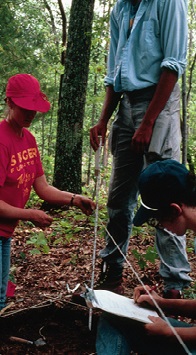
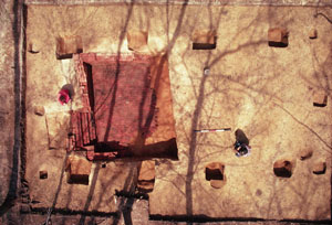
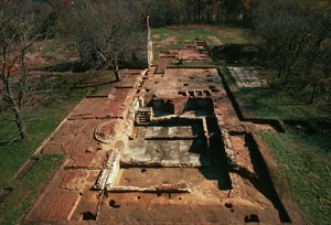
Imposing a three-dimensional horizontal and vertical grid is the only way of establishing spatial control at an archaeological site. All points in a grid are related to a datum, a reference point of assigned horizontal and vertical location. Usually, archaeologists will designate this point with a metal pipe. After the datum point has been established, a physical grid is created over the area of examination with a surveyor's transit. The value of this system is that every point, within the boundaries of the grid, is known in relation to every other point and all artifacts can be recorded in spatial terms. Click on the "Dig Deeper" to see more examples of archaeological sites and select the "Try It!" icon to see if you can imagine what a building looked like from the archaeological footprint.
Imposing a three-dimensional horizontal and vertical grid is the only way of establishing spatial control at an archaeological site. All points in a grid are related to a datum, a reference point of assigned horizontal and vertical location. Usually, archaeologists will designate this point with a metal pipe. After the datum point has been established, a physical grid is created over the area of examination with a surveyor’s transit. The value of this system is that every point, within the boundaries of the grid, is known in relation to every other point and all artifacts can be recorded in spatial terms. See the “Dig Deeper” to see more examples of archaeological sites.
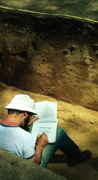
Archaeologists destroy sites! Yes, by their excavations they destroy the very source of their research, the interrelationships among artifacts and features. It is very important that archaeologists properly map a site as they are excavating it. The drawings and photographs will be all that is left to tell people about the site. Mapping of a site may be done by hand (shown on left) or, more commonly now, with laser-surveying equipment that can record hundreds of points in a day and transfer location information to a geographic information system (GIS).
Archaeologists find sites by looking for artifacts on the surface of the ground in places where it is environmentally desirable to live, such as well-drained land near streams. Since the surface of Virginia is eroding down, most archaeological evidence is contained in the top three feet of soil. Deeper sites are typically found in flood plains or as cellars or wells on historic sites. The best time to surface collect a field is after it has been plowed and rained upon. Normally archaeologists will conduct controlled surface collections, in which the field is divided in twenty-foot blocks and the artifacts are kept separate by similar-sized blocks.
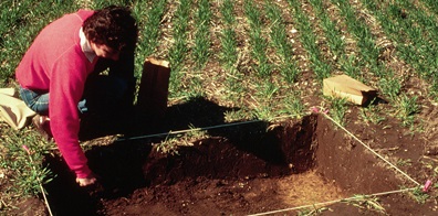
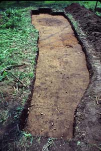
Once the site has been located through surface collection, archaeologists will take a peek at it by digging a series of small squares called test units. The test units are just big enough for an archaeologist to work comfortably in and to expose enough surface area to see the underlying strata and any features that may be there. Since any type of excavation is destructive to the site, archaeologists want to expose just enough to obtain basic information about the site size, as well as artifact and feature concentrations at the site.
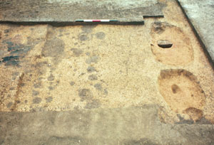
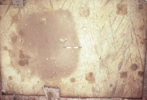
For delicate excavation an archaeologist will drop the shovel and pick up a trowel. An archaeologist uses a trowel in various ways. The point and edge of the trowel are used for careful excavation. But, the edge of the trowel is mainly used to scrape the surface of an excavated level or profile to bring out the color and texture of the soil. In a sense it is like shaving the surface of the soil. The archaeologist then interprets the clean soil surface, noting soil layers in a profile or discolorations, called features, in the floor of a square. Trowelling is done not only to interpret the soil, but to provide a clean surface for photographing the excavation to document for posterity. Click on the "Try It" icon and excavate a site.
For delicate excavation an archaeologist will drop the shovel and pick up a trowel. An archaeologist uses a trowel in various ways. The point and edge of the trowel are used for careful excavation. But, the edge of the trowel is mainly used to scrape the surface of an excavated level or profile to bring out the color and texture of the soil. In a sense it is like shaving the surface of the soil. The archaeologist then interprets the clean soil surface, noting soil layers in a profile or discolorations, called features, in the floor of a square. Trowelling is done not only to interpret the soil, but to provide a clean surface for photographing the excavation to document for posterity.
Archaeologists look at sites not only in plan view but also in profile in order to interpret the passage of time at the site. In general, layers, features, and artifacts that are deeper in these vertical cross-sections are older than whatever is nearer the ground surface. It is essential that archaeologists obtain both views of a site, particularly if the site is a deeply buried stratified site. Proper interpretation and recording of the profile will assist archaeologists in placing layers, features, and artifacts in time. Click on the "Try It!" icon and see what can be learned from a site profile.
Archaeologists look at sites not only in plan view but also in profile in order to interpret the passage of time at the site. In general, layers, features, and artifacts that are deeper in these vertical cross-sections are older than whatever is nearer the ground surface. It is essential that archaeologists obtain both views of a site, particularly if the site is a deeply buried stratified site. Proper interpretation and recording of the profile will assist archaeologists in placing layers, features, and artifacts in time.

Images of grid excavations

House Excavation
House Excavation
Features surface subsoil
Semi-Sub Structure
Semi-Sub Structure
Kingsmill Cellar
Kingsmill Cellar
House Excavation
House Excavation

FAQ

Question: What is archaeology?
Answer: Archaeology is a subfield of anthropology, which is the study of people. Archaeology is the scientific study of past cultures through the systematic recovery and interpretation of their material remains (artifacts).

Question: How do you know where to dig?
Answer: Archaeologists look for artifacts on the surface of the ground in places that are environmentally desirable to live, such as well-drained land near streams.

Question: How deep do you dig?
Answer: Since the surface of Virginia is eroding down, most archaeological evidence is contained in the top three feet of soil. Deeper sites are typically found in flood plains or as cellars or wells on historic sites.

Question: How do you understand what is in the soil?
Answer: The soil is carefully excavated and troweled to bring out the color and texture. An archaeologist reads the soil to identify different layers and features that can be seen in the soil with a trained eye. Recognizing and maintaining the context of the artifacts in the layers and features is most important.

Question: What is the most valuable artifact that you have found?
Answer: The site is the most valuable artifact to an archaeologist. Without the context that a well-preserved site provides, the other artifacts provide very little information about the people who lived there and their culture.